Spring-fed pools, lagoons at the foot of the volcano and pine forests in the mountains. The places this guide brings together, with their location, services and hours.
Volcanoes, hills, viewpoints and sierra in Colima, Villa de Álvarez, Comala, Minatitlán, and Ixtlahuacán. Among them, the Colima Volcano, the Nevado de Colima and El Terrero.
A ravine a few steps from the church of the town of Suchitlán, on the slopes of the Colima Volcano. A cobbled, somewhat steep path of about 150 meters goes down to a clear river running between plants and large rocks, with a suspension bridge across it. On the other side, a stone path climbs for a better view of the landscape. There are no signs: just ask the locals.
A former railway station on the line that brought timber down from Cerro Grande, today a small mountain community in Comala inside the Sierra de Manantlán Biosphere Reserve. Its main attraction is the mountain scenery, with viewpoints toward the volcanoes, interpretive trails and camping areas. Local guides lead walking, mountain biking or horseback tours to places such as the Pozo de la Peña.
Viewpoint hill of about 770 meters above sea level, south of the city of Colima, along the Colima–Tepames road. A cobblestone road reaches the summit by car and several trails allow hiking up. At the top there is a chapel and a lookout with views of the city and the valley, as well as a paragliding take-off point. The best season is the dry one, from November to May.
A mountain community in Comala, near the Jalisco border, famous for Colima's first hydroelectric plant, inaugurated in 1906 and fed by two ponds that are now used for recreational fishing and rowing. There is a community museum about the plant, a guided trail that descends a cliff, remains of the Camino Real, dugout shelters (fortines) from the Cristero War, a camping area, simple cabins and a thatched-roof restaurant overlooking the lake.
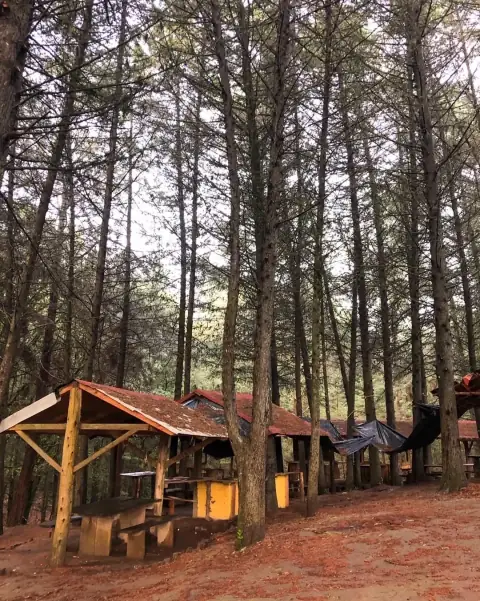
El Terrero es una hermosa localidad enclavada en las montañas de Minatitlán, Colima. Es un destino perfecto para los amantes de la naturaleza y la tranquilidad, rodeado de exuberantes bosques de pino y encino. El clima fresco y la atmósfera serena hacen de El Terrero un lugar ideal para desconectar del bullicio de la ciudad y disfrutar de actividades al aire libre como senderismo, avistamiento de aves y campismo. La belleza natural y la hospitalidad de su gente hacen que visitar El Terrero sea una experiencia única y revitalizante.
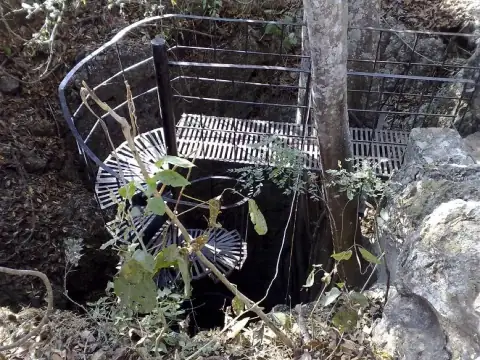
Limestone cave in the San Gabriel ejido, in the mountains of the municipality of Ixtlahuacán. A metal spiral staircase leads down to a large vaulted chamber with stalactites and stalagmites; remains there suggest an ancient pre-Hispanic ceremonial center. Visits are always guided by the family that looks after the site, and there is an entrance fee per vehicle. It is hot and humid inside, and the floor gets slippery in the rainy season.
La Gloria Escondida es un santuario natural rodeado de exuberante vegetación y formaciones rocosas impresionantes. Su entorno ofrece un ambiente perfecto para la aventura y la relajación, con senderos que invitan a la exploración y paisajes que cautivan con su belleza. Es un destino ideal para los amantes de la naturaleza, donde se puede disfrutar de la tranquilidad, el aire puro y el sonido del agua fluyendo entre las rocas.
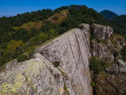
Natural viewpoint in the Sierra de Manantlán Biosphere Reserve, near El Terrero, in Minatitlán, on a thin ledge of rock that gives the place its name. It is reached after a walk of about 30 minutes through cloud forest, among bromeliads, orchids and moss, and offers a panoramic view of the mountains. Going with a local guide from El Terrero is recommended; the walk often takes longer than expected.
Protected natural area of 9,375 hectares, decreed in 1936, that safeguards the Nevado de Colima and the Volcán de Fuego, with pine, oak and fir forests. About 89% lies in Jalisco and only around 11% belongs to Comala and Cuauhtémoc, in Colima. It is a destination for hiking, mountain biking and official campsites; the access most used by visitors is through Ciudad Guzmán, Jalisco.
A gigantic rock monolith, about 1,466 meters above sea level, visible from much of the Colima valley and surrounded by legends, among them that of King Colimán's tomb. A mountain trail leads up from the spot known as La Herradura, in Juluapan. It is a long, steep walk, hard but not especially dangerous, rewarded with one of the best views of the valley.
One of the most important protected natural areas in the region, with almost 140,000 hectares between Jalisco and Colima; on the Colima side it covers Comala and Minatitlán. It protects pine-oak and cloud forests, more than 2,900 plant species and wildlife such as jaguar, puma and green macaw. It offers hiking, viewpoints, ejido cabins in El Terrero and waterfalls such as El Salto.
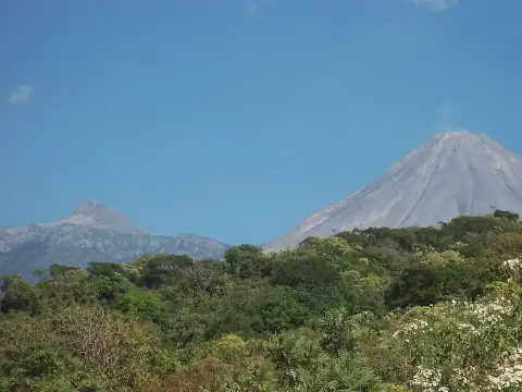
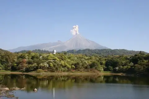
Known as the Volcán de Fuego, it is one of Mexico's most active volcanoes and rises more than 3,800 meters above the Colima valley, on the border with Jalisco. Access to the summit is prohibited because of its activity, but it can be admired from a distance from Comala, Suchitlán and the Carrizalillo and La María lagoons; on clear days steam plumes are visible. Together with the Nevado de Colima it is part of a national park.
A stretch of about 300 meters of the Comala–Suchitlán road, near kilometer 6, where a car in neutral, a bottle or even water seems to roll uphill instead of downhill. Students from the Faculty of Sciences of the University of Colima studied it in 2016 and attributed it to an optical illusion of the terrain. It is a roadside curiosity for a short stop, between Comala and Suchitlán.